
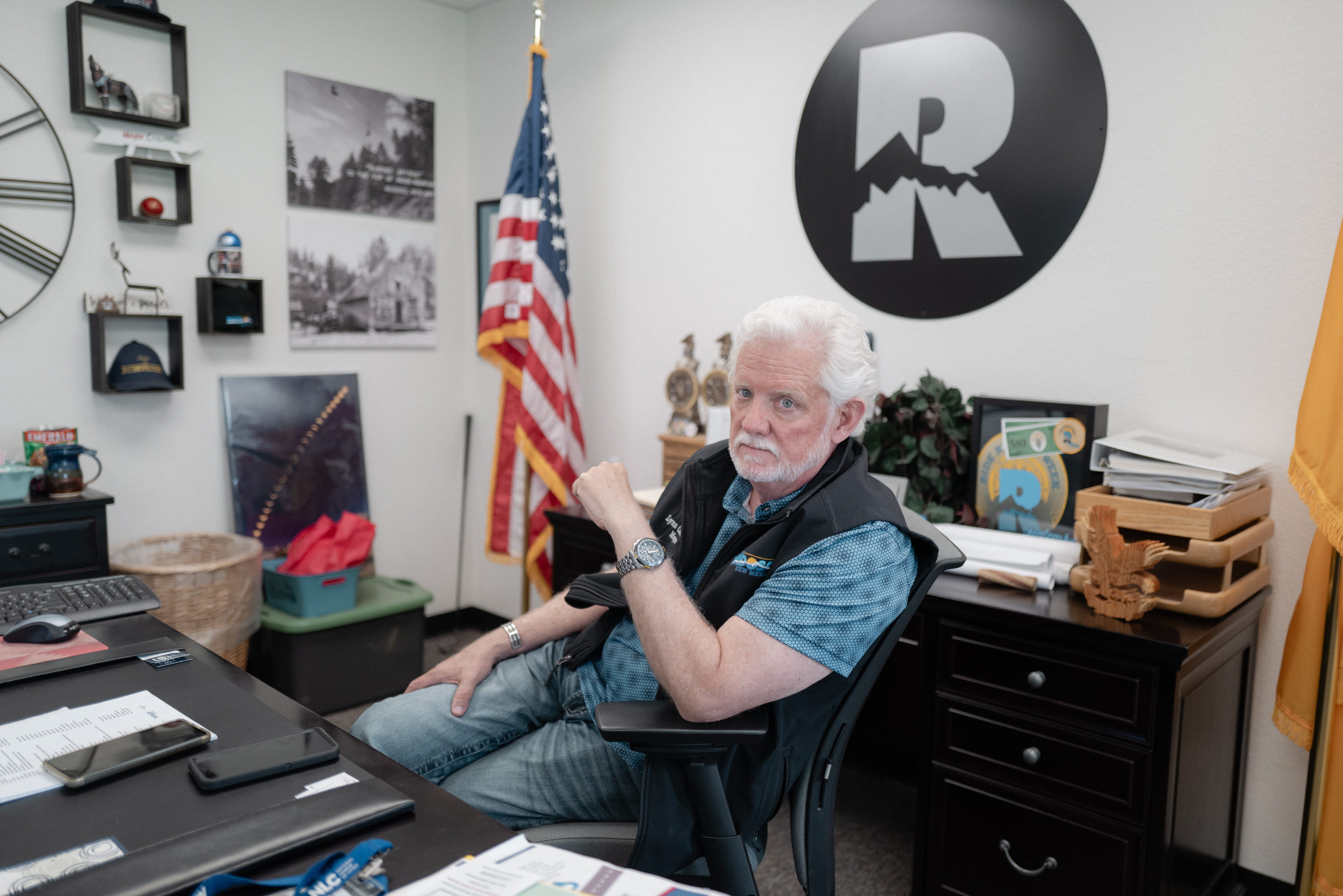
Peak tourist season had arrived in Ruidoso, New Mexico, and Mayor Lynn Crawford was aggressively campaigning to convince the public that the mountain village was completely safe. A Republican with white hair and a distinctive Texas drawl, Crawford made no secret of his frustration with local residents who were sharing anxious warnings about potential flooding on social media. "They spout stuff off," Crawford said in a radio address on June 30, 2025. "And I don’t know why they’re so afraid. I do not understand it."
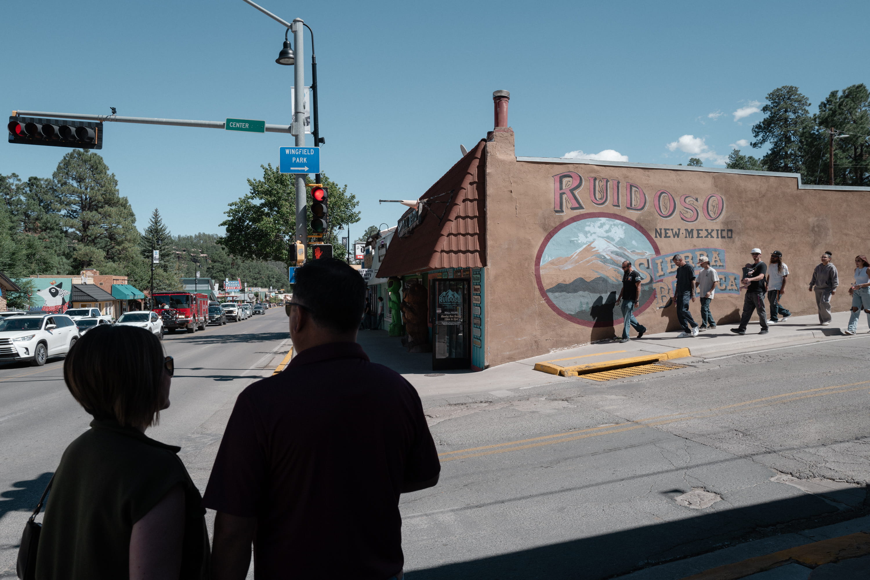
The community had experienced severe, devastating flooding the previous summer, immediately after two massive wildfires burned 25,000 acres of timber and brush high above the town in the Sacramento Mountains. Combined, those fires and subsequent floods had destroyed roughly 1,000 homes. Together, the Village of Ruidoso and its smaller neighbor, Ruidoso Downs, are home to some 10,000 permanent residents, but that population more than doubles during the warm summer months as tourists flood the region.
Since the previous year’s disasters, residents had remained perpetually on edge. A fresh monsoon season had arrived, bringing sporadic, unpredictable flooding that directly jeopardized the town’s primary economic engine: horse racing and summer tourism. At stake were the large crowds anticipated to celebrate the Fourth of July, watch lucrative quarter horse racing, and enjoy the cool mountain weather that had lured generations of Texans to the area.
"We have flooding temporarily," Crawford had told a Texas news anchor in an interview ahead of the summer rush. "And just almost as fast as it came to town, and went through town, it’s gone." Crawford, who is 64, managed an exclusive club at the Ruidoso Downs Race Track & Casino and had once referred to that position as his "real job." He earned less than $26,000 annually as the village mayor.
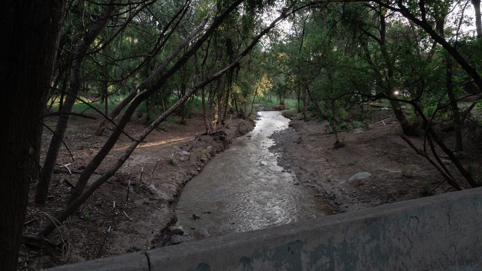
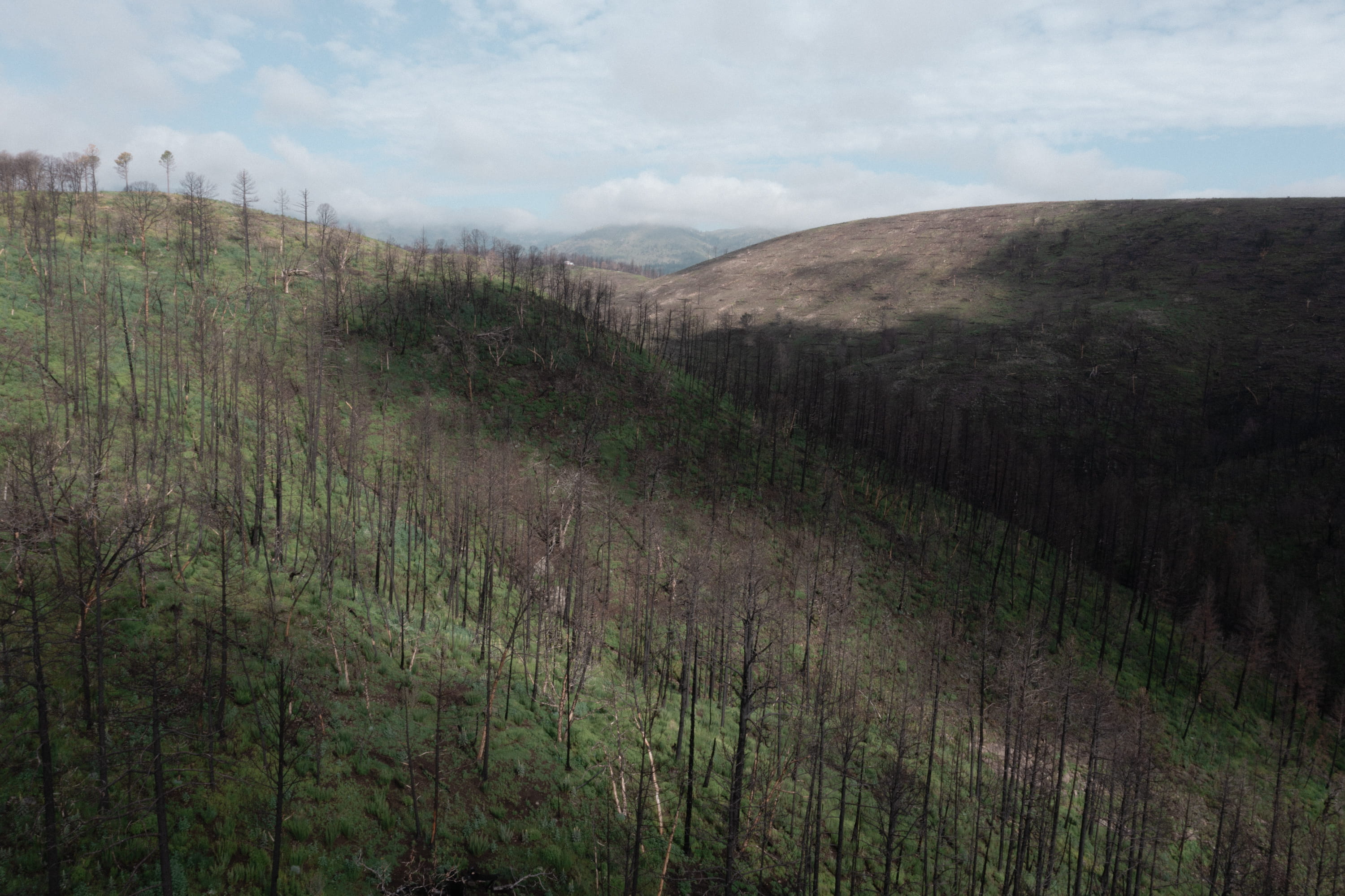
Yet if the town’s economy was precarious, its geography was even more dangerous. The South Fork and Salt fires had severely charred the landscape, leaving behind hydrophobic soils that could no longer absorb rainwater. To understand the phenomenon, scientists suggest imagining spilling hot wax on a carpet, letting it cool, and then repeatedly pouring water over it. Now place that water-repellent wax layer on steep hills directly above a river lined with log homes, tourist shops selling wooden bears, and an iconic, historic racetrack.
Local and state officials were acutely aware of the threat, but they clung stubbornly to Ruidoso’s core animating idea: that nature could be systematically subdued for the enjoyment of tourists and the economic profit of the community. Nowhere was this philosophy more apparent than at the racetrack itself, where the Rio Ruidoso, channeled through concrete culverts, crossed directly through the infield. After the 2024 flooding severely damaged the track, those culverts had been completely rebuilt using a $16 million public investment authorized by New Mexico’s Democratic governor, Michelle Lujan Grisham.
The track had only recently reopened to the public, and rising floodwaters were once again threatening to derail the racing season. On June 26, internal municipal records show, Ruidoso’s emergency management department was operating at a heightened threat awareness level. Flooding had already destroyed a bridge upstream of the town, and local forecasts called for sustained rainfall.
Yet publicly, village officials maintained they were fully prepared and that the community was entirely safe. The very next day, the local emergency manager reduced the threat level a notch, and the village communications department publicly chided residents for sharing warnings of catastrophic flooding on social media, emphasizing that some online posts featured outdated videos. "Protect our community from fear-based falsehoods," the village implored in a widely shared public service announcement.
On July 4, just one state over, violent flash flooding killed more than 130 people in central Texas. However, multiple tourists arriving in Ruidoso for the holiday weekend said they had no idea the town was facing severe danger. At the racetrack, the horses ran as scheduled, and Mayor Crawford hosted affluent members at the exclusive Ruidoso Jockey Club, where private tables commanded prices as high as six figures.
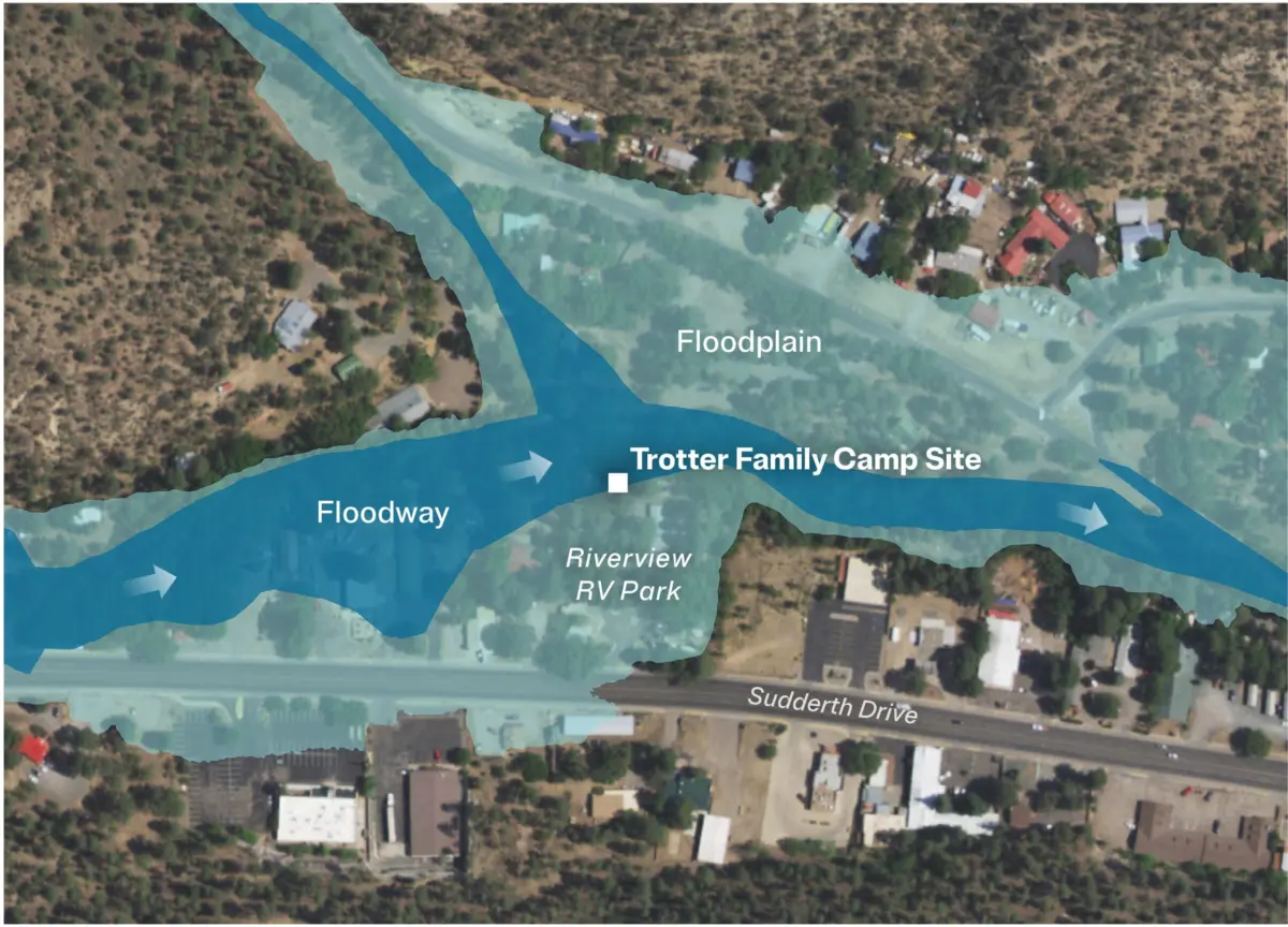
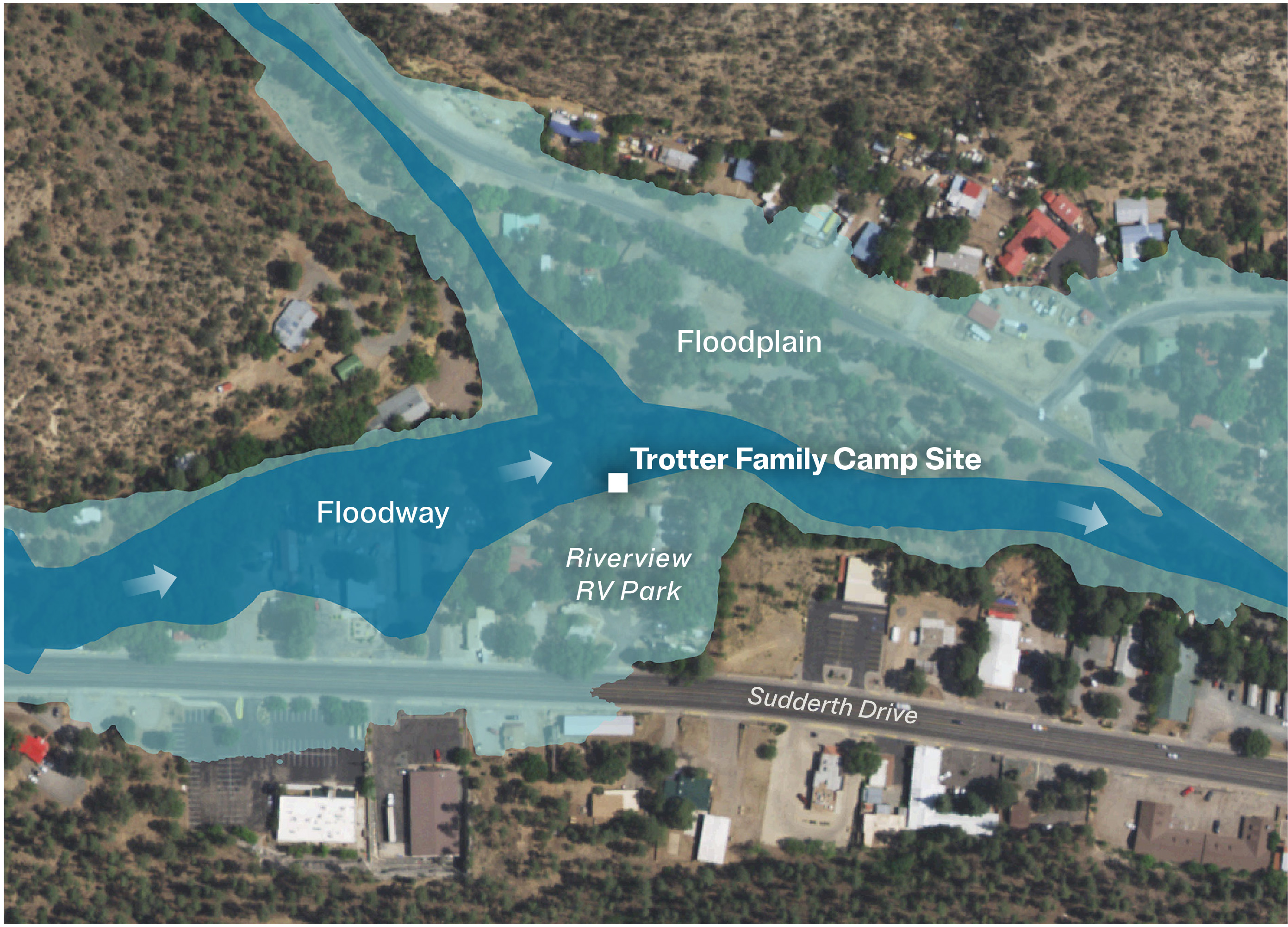
That weekend, Sebastian Trotter and his family traveled to Ruidoso from El Paso, Texas. Sebastian was an active-duty Army helicopter pilot stationed at Fort Bliss; his wife, Stephanie, was a nursing student. Believing the mountain village looked exceptionally family-friendly and seeing no warnings online, they packed up their two children and three dogs for a summer getaway. On Sunday, July 6, they parked their travel trailer in a prime spot directly on the water’s edge at the Riverview RV Park. In online photographs, the river appeared gentle and inviting. "You could go put your toes in," Sebastian recalled later.
That afternoon, the Rio Ruidoso—whose name translates from Spanish as "noisy river"—briefly flooded its banks, prompting local firefighters to rescue at least four people. The Trotters watched the water rise, but the campground host assured them that minor flooding was a regular occurrence during the monsoons. Soon enough, the river receded back into its channel.
Inside the park, the Trotters’ children, 7-year-old Sebastian Rowan and 4-year-old Charlotte, rode their bicycles beneath the tall pine trees. The young boy was an avid soccer player enchanted by the idea of camping in the deep woods; Charlotte was bright and cheerful, known for applying sparkling glitter to her father’s mustache. Later that day, the family walked through the village, where elk and wild horses occasionally graze peacefully near tourists.
On Tuesday, July 8, the Trotters were visiting a nearby lake when dark storm clouds began forming over the peaks. Deciding to head back into town, they ordered pizza before allowing the children to pick out small souvenirs. Young Sebastian selected a colorful rainbow gemstone, while Charlotte chose a matching bracelet and ring. They then returned to the RV park to relax by the river as the afternoon wore on.
At 1 p.m., Mayor Crawford presided over a scheduled council meeting at Village Hall. He opened the proceedings by recognizing the tragic Texas flood victims and noting Ruidoso’s relative success in avoiding a similar disaster. "We want to keep all of central Texas in our thoughts and prayers and see how bad it was and how fortunate we’ve been," he said. "The goal of the village is to protect the village." That mandate, he argued, meant carefully balancing public safety with the vital demands of local tourism.
At almost the exact same moment, towering storm clouds gathered densely over the surrounding mountains. Even short periods of moderate rainfall on severe burn scars can instantly unleash catastrophic post-fire floods. By 1:30 p.m., radar data indicated that severe storms were poised to douse both burn scars simultaneously. Just before 2 p.m., local firefighters texted radar images among themselves. "It could be interesting," one wrote. At the time, only about a third of the fire department was actively on duty, and Fire Chief Cade Hall had spent weeks declining to position additional flood rescue specialists near vulnerable low-lying areas. Chief Hall later disputed ProPublica’s reporting regarding the emergency response but declined to comment with specific details.
Less than an hour later, a massive new flood arrived, carrying heavy debris that quickly backed up behind local bridges. The water kept rising, spilling aggressively onto roads until the normal, recognizable course of the river completely disappeared. The sheer volume of brown water and the heavy debris it carried signaled to long-term residents that it was time to panic.
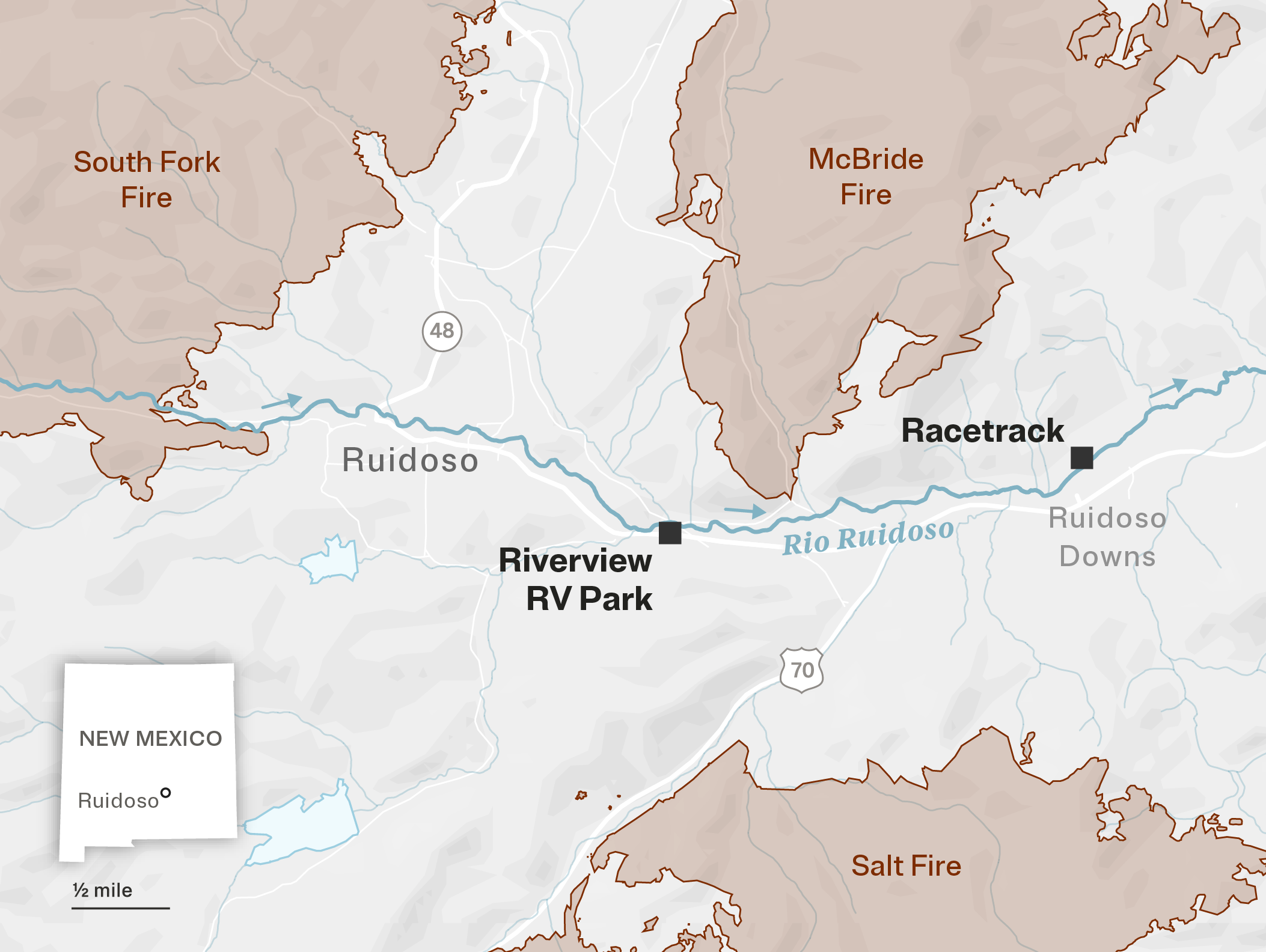
Jason Fulcher, one of the owners of the Riverview RV Park, spotted a tree-size log barreling down the waterway. Two miles downstream, a maintenance worker at a mobile home park watched in horror as an empty car floated past and wedged firmly against a bridge.
Further downstream, executives at the Ruidoso Downs racetrack did not need physical signs of rising danger; they already knew what was coming because they had received direct advance warnings.
The Trotter family, however, was caught entirely unprepared. Around 3 p.m., they retreated inside their travel trailer to escape the heavy rain. Moments later, a destructive wall of water tore through the RV park wall and swept their children away.
The wildfire crisis currently engulfing the American West presents a secondary, cascading threat that has historically received far less public attention: entire neighborhoods can be washed away in debris flows and flash floods that inevitably follow major fires. Scientific research demonstrates a direct correlation between fire intensity and downstream flood risk. Studies show that if more than 20 percent of the ground burns at moderate to high severity—particularly on steep mountain slopes—there is an exponentially increased danger of deadly debris flows and post-fire flooding during seasonal storms. The fires that burned above the Rio Ruidoso watershed had vastly exceeded that critical threshold.
Prior to the 2025 tourist season, local and state officials had ample opportunity to safeguard Ruidoso and adapt to the harsh realities of a warming climate that is undeniably worsening both wildfires and floods. Both the state government and the village commissioned independent engineering experts to model various flood scenarios. Those technical reports predicted devastating, high-volume flooding. "They told us exactly where it was going to come and what it was going to do," acknowledged Fire Chief Hall. Furthermore, federal emergency officials explicitly suggested that significant portions of the town should be relocated away from the river corridor entirely.
Instead, political leaders ranging from the local mayor to the state governor recommitted themselves fully to preserving tourism and protecting the racetrack.
Since the fatal July 8, 2025 flood, municipal officials have consistently insisted that they performed admirably in the face of a historic, unpredictable disaster. Michael Martinez, the village’s former deputy manager who helped direct the emergency response, stated, "We’re lucky we didn’t have a Texas."
However, according to five first responders who spoke on the condition of anonymity out of fear of professional reprisal, the tragedy could easily have been avoided. Their accounts are corroborated by public records, including internal emails, municipal reports, and detailed hydrologic assessments. Before July 8, Crawford, Hall, and other leaders made deliberate choices that left residents and unsuspecting tourists profoundly vulnerable, even though they knew a destructive flood was highly likely, according to first responders and former officials.
Some of those choices, such as the village’s aggressive marketing of tourism to visitors who were completely unaware of the local geography and risks, appeared to be financially motivated. "Money was the driver," said Thora Walsh Padilla, former president of the Mescalero Apache Tribe, whose ancestral lands lie south and west of the town. "You’re taking a chance with people who aren’t even from this area and don’t know how to get around enough. You’re putting them in jeopardy."
Other critical missteps stemmed from sheer inaction: the failure to relocate vulnerable residents living in the floodplain and the failure to replace aging infrastructure damaged during previous floods, even as Governor Lujan Grisham drove a $16 million state investment into the racetrack. Moreover, just moments before the deadly flood arrived, at least one of the RV park’s owners received automated emergency alerts but failed to evacuate the campers.
Village officials, including Mayor Crawford, declined to respond to more than 70 detailed questions from journalists, including inquiries regarding whether they prioritized racetrack tourism over public safety. However, in an interview the previous year, Crawford remarked, "Who’s to blame? I didn’t start the fire."
Reached by phone, Kerry Gladden, the village’s public information officer, referred all questions to an attorney, who did not respond. Village officials have defended their communications by noting that their emergency department sent text-message warnings ahead of the flood through an opt-in public notification system.
A spokesperson for Governor Lujan Grisham maintained that state investments in the racetrack were entirely necessary to protect life and safety from potential structural failures. The racetrack’s general manager, Rick Baugh, did not respond to multiple inquiries, and one of the racing operation’s owners did not answer emailed questions.
The profound lapses and missed opportunities in Ruidoso offer stark, challenging lessons about the grim reality facing communities across the American West. Following the disaster, post-fire flooding and debris flows killed one person and triggered numerous rescues in Colorado. Flash floods in the Grand Canyon killed three people, with some floodwaters coursing over burn scars. In Utah, Governor Spencer Cox declared a state of emergency following severe post-fire flooding across three counties.
Despite these mounting dangers, the West remains largely unprepared for the spreading threat. While federal scientists have developed a national model to assess post-fire debris-flow hazards, local communities still lack an easily accessible tool to accurately gauge their specific risks of post-fire flooding.
Today, Ruidoso still maintains the aesthetic of a bustling mountain tourist hub, but its continued existence relies heavily on staggering amounts of disaster aid from state and federal coffers. Since 2024, state and federal agencies have poured more than half a billion dollars into disaster recovery in Ruidoso—an amount nine times the village’s entire annual operating budget. Even with this unprecedented influx of funding, local first responders warn that the village remains dangerously unequipped to protect residents and visitors alike.
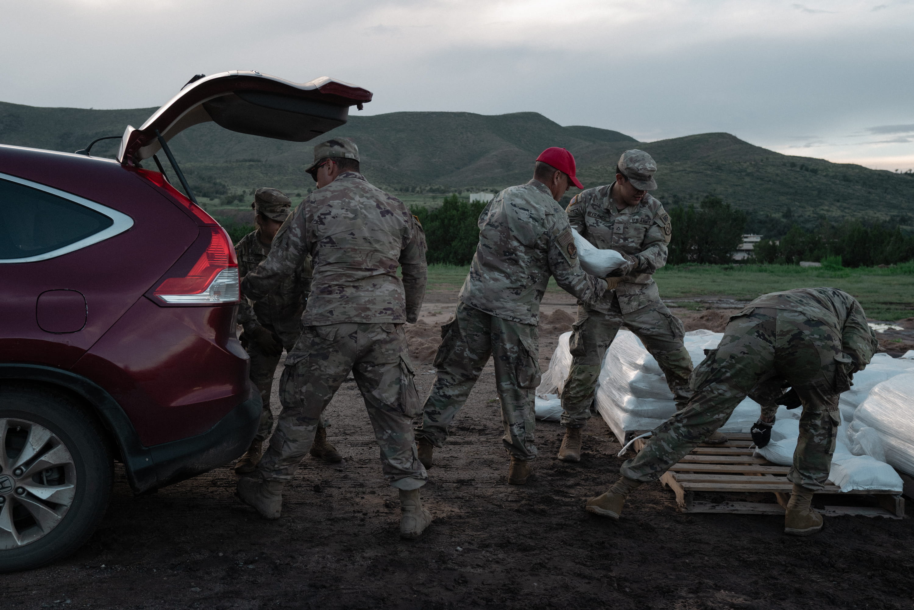
The community’s historical roots contributed heavily to the catastrophe. Ruidoso’s colonial founders chose to establish their town directly on the riverbanks, a site the Mescalero Apache historically avoided by living on the surrounding hills to escape rising waters and mosquitoes. Over the decades, the Rio Ruidoso flooded repeatedly, including notable events in 2008 and 2022. Randall Camp, the former Lincoln County manager and public works director for Ruidoso, bluntly noted, "The river can’t be trusted."
Many newer residents fundamentally misunderstood this risk. Jason and Lindsey Fulcher, for instance, moved to Ruidoso from the Houston area in 2022 seeking a quiet life close to family. The 1.5-acre property they purchased sat just below the confluences of the Rio Ruidoso and two major tributaries. They arrived just as the region’s wildfire and flood crisis reached unprecedented extremes.
Decade-old research from Northern Arizona University examining tree rings on the Mescalero Apache reservation revealed that natural fires occurred regularly every six to 18 years until the early 20th century, when aggressive federal suppression policies began. As fire frequency declined, the surrounding forests grew unnaturally dense, drawing tourists with thick shade. "This isn’t natural. It’s not natural anymore," Walsh Padilla observed.
The U.S. Forest Service’s long-standing policy of rapidly extinguishing all wildfires is symbolically tied to Lincoln County, where firefighters in 1950 rescued a singed bear cub from the mountains northeast of Ruidoso. Named Smokey Bear, the cub became the living icon for the agency’s famous fire prevention campaign. But as the climate steadily warmed, decades of total fire suppression fundamentally transformed the landscape. Federal data shows that between 1950 and 2010, wildfires in the Rio Ruidoso watershed burned just under 11,000 acres. Since then, nearly 54,000 acres have burned—an area nearly five times larger than the previous six decades combined. Scientists confirm these modern fires burn much hotter as heavy timber dries out in a warming climate.
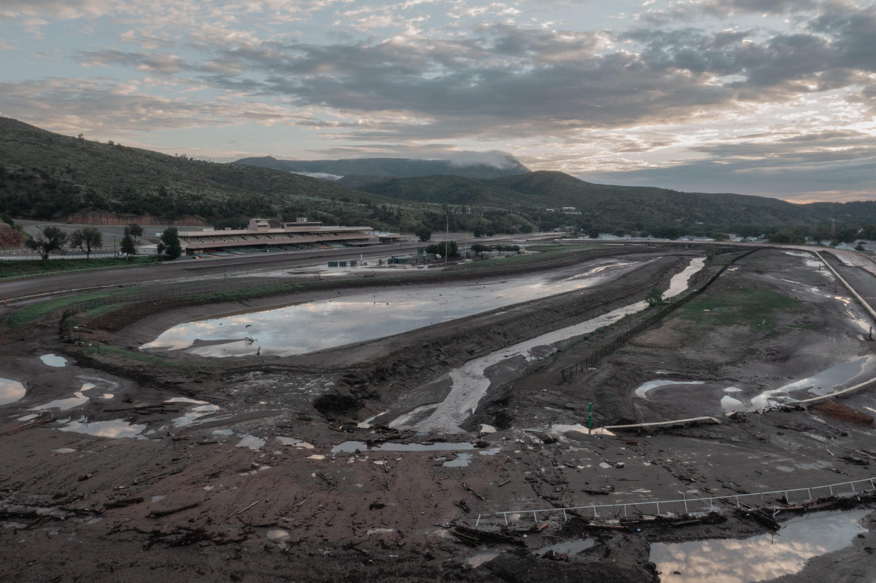
When two major fires ignited in June 2024, monsoon rains followed swiftly, unleashing a devastating 16-foot flood through the town on July 20, 2024. The Fulchers’ home sustained minor damage, but their relatives’ property further upstream was completely destroyed. Deemed uninhabitable by FEMA, the property owners were barred from rebuilding, prompting them to close their RV park for the season. "I wasn’t going to put people in harm’s way because I wanted their money," Chelsey Jarvis told the village council in October 2024, pleading with officials to buy out their land. "It’s just going to be Groundhog Day. Next year it’s going to wash away."
Federal agencies like the Natural Resources Conservation Service explored large-scale buyout programs similar to post-flood relocations funded elsewhere in the country. Local officials estimated it would cost roughly $650 million to relocate about 1,000 properties, but federal funding required a 25 percent local match that neither the county, village, nor state was willing or able to finance.
By the spring of 2025, with prospects for a mass relocation fading, official optimism returned to public discourse. Village leaders encouraged park owners to reopen to maintain affordable rentals for the tourist season. While some families kept their parks only half-booked, Jason Fulcher, having exhausted his retirement savings to finance his $645,000 property, felt compelled to operate at full capacity through the summer monsoon months to avoid losing money every month.
On March 31, 2025, the village released an updated online floodplain map based on models created by engineering firm Cobb, Fendley & Associates. Months earlier, the engineers had warned village officials of a dire scenario: a 100-year storm could bring six times the volume of the destructive July 2024 flood and identified over 200 at-risk addresses, including the RV parks. However, municipal officials framed the new map primarily around building permits and development regulations rather than communicating the immediate threat to human life. "There was never a time where we specifically said, ‘Someone can die,’" admitted former deputy manager Martinez.
Both RV parks sat squarely within the floodplain, yet property owners had internalized the government’s public messaging. "The leadership dang sure makes you feel like it’s gonna be OK," said Darrel McKay. "All they kept saying was build back better. We’re stronger."
On May 25, 2025, Governor Lujan Grisham celebrated the rapid reopening of the Ruidoso Downs racetrack, bolstered by $16 million in state infrastructure funding. State transportation officials had prioritized excavation of an 8-acre holding basin in the track’s infield and the reconstruction of culverts under the track to protect the facility and allow racing to resume. While state officials defended the expenditure as a necessary life-safety measure to protect downstream communities from structural dam failure, critics and track executives openly acknowledged that the primary objective was restoring tourism and drawing visitors back from Texas.
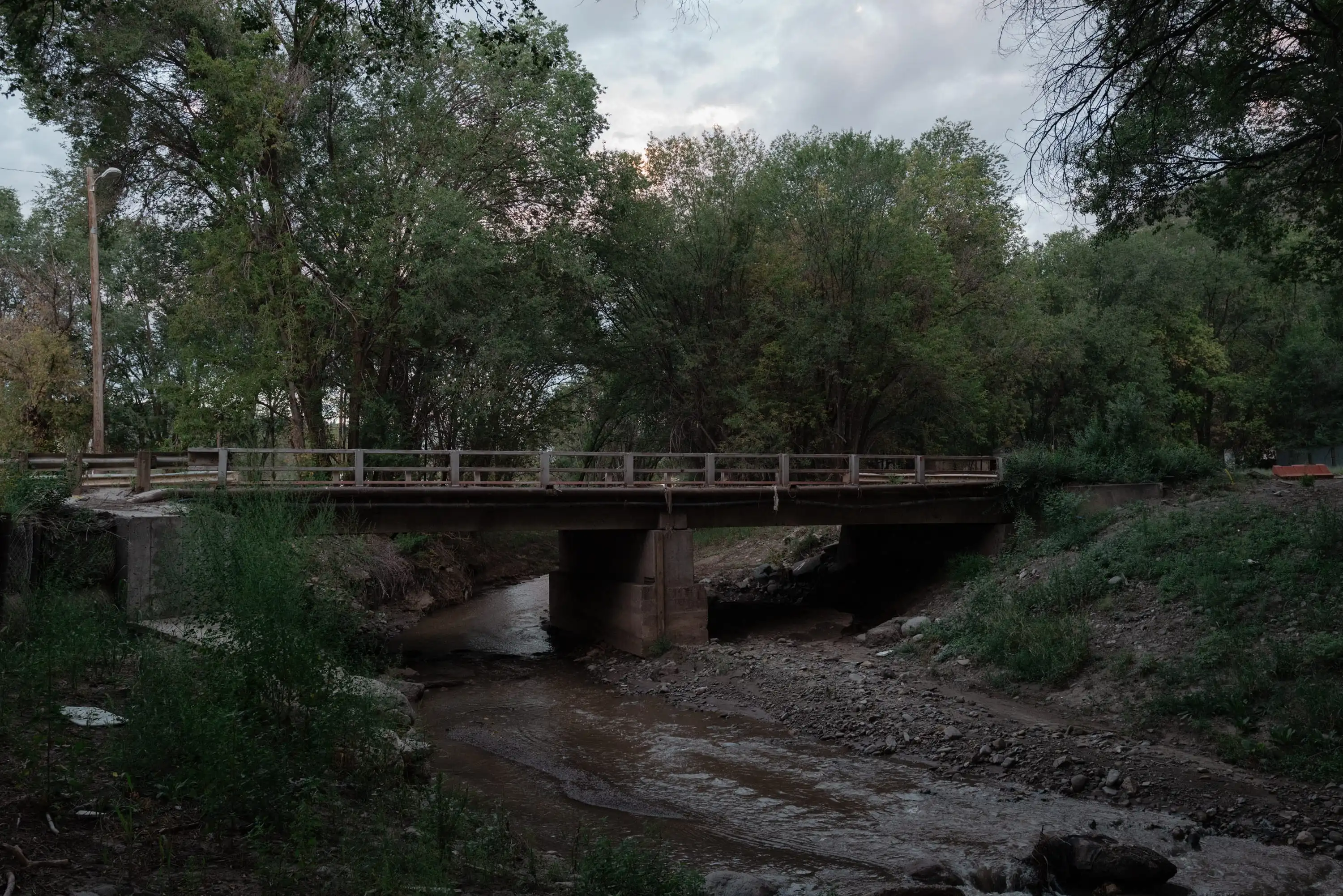
Meanwhile, critical mitigation projects upriver—such as repairing and replacing damaged bridges and culverts that could trap debris and act as artificial dams—lagged due to jurisdictional disputes between state and local authorities.
By early July, heavy afternoon rains began triggering frequent minor rescues. On July 8, just before 2 p.m., intense rainfall slammed the headwaters of the Rio Ruidoso. Within minutes, nearly three-quarters of an inch of rain pelted the charred mountain slopes. The National Weather Service issued a flash flood warning, quickly upgrading it to a flash flood emergency as massive debris flows surged down into the river.
At Village Hall, Mayor Crawford adjourned the council meeting at 3:10 p.m., announcing, "We’ve had a wall of water come over. It’s predicted this is the big one." Crawford promptly called the racetrack’s general manager, giving track executives about 45 minutes of advance notice. That warning allowed track management to successfully evacuate dozens of grooms living in the barns before the floodwaters arrived.
Three miles upstream at the Riverview RV Park, campers remained entirely unaware of the impending catastrophe. Although automated emergency alerts had been sent out, residents experienced severe "alert fatigue" from receiving daily weather warnings. No municipal emergency personnel were dispatched to drive through the RV park with loudspeakers, despite its proximity to the local fire department.
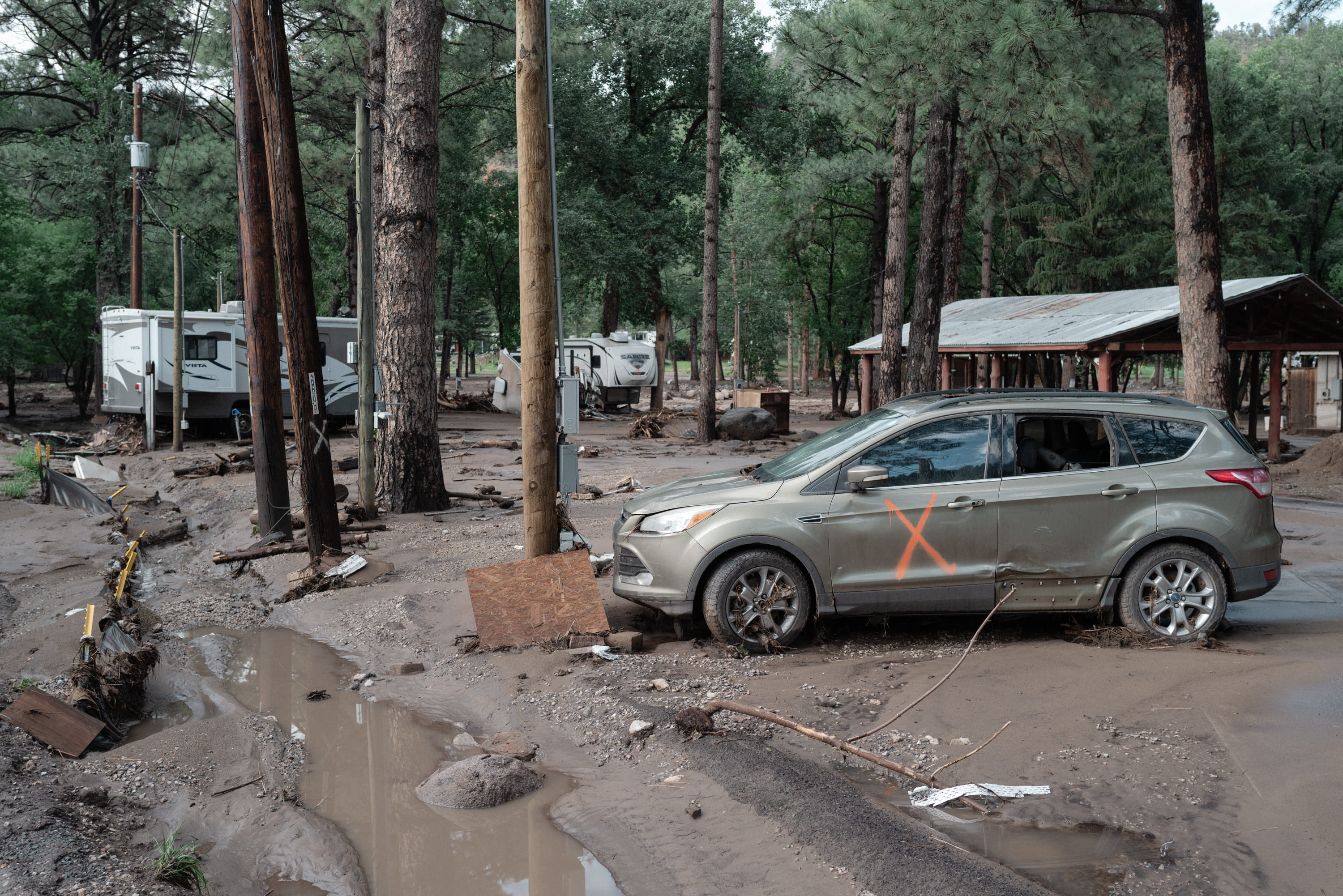
When the massive wall of brown water struck the RV park around 3:30 p.m., it tore through the Trotters’ travel trailer. Stephanie Trotter and her two children were swept into the violent current. While first responders managed to rescue Stephanie and several other campers, young Sebastian Rowan and 4-year-old Charlotte were carried away by the flood. Search teams recovered the body of camper Benjamin Timothy Feagin under a bridge later that afternoon, followed by the tragic discovery of the two children’s bodies by evening search parties.
In the aftermath, state and local leaders continued to defend their emergency response, insisting they had done everything possible to protect the public. Yet the internal records, engineering models, and accounts of first responders paint a starkly different picture—one of a community that consistently chose economic tourism and the preservation of its iconic racetrack over transparent warnings and human safety.
Today, the Riverview RV Park sits abandoned and wrapped in police tape, with a small white memorial cross and plaque bearing the names of Tim Feagin, Sebastian Rowan Trotter, Charlotte Emery Trotter, and their two dogs hanging from a towering pine tree. Just downstream, however, tourism advertisements continue to flash on digital billboards in West Texas, and new families continue to populate riverside trailer parks, confident that the river remains welcoming on a quiet summer day.