
The American Southwest has recently experienced an overwhelming abundance of a resource it typically lacks: water. Following a series of ferocious, high-impact storm systems that inundated desert communities and claimed at least four lives, climatologists and regional emergency officials are grappling with the unprecedented extremes of modern weather patterns. While precipitation remains an essential, life-giving component of the arid Southwestern climate, the region recently absorbed two to three months’ worth of rain in just a matter of days—delivering a staggering volume of water that far exceeded the capacity of local human infrastructure to manage all at once.
The numbers paint a startling picture of the meteorological anomaly. In Clovis, New Mexico, an astonishing 28.84 inches of rain has fallen since September 20, obliterating historical averages for the area, where the baseline expectation sits at a meager 3.3 inches. Similar historic deluge events have played out across neighboring states, compounding the struggles of residents who were already navigating difficult environmental conditions.
"This weekend was just adding more on the rough times that those communities in Southwest Colorado and Arizona and Utah and New Mexico have been having recently," said Russ Schumacher, director of the Colorado Climate Center at Colorado State University and the state’s climatologist. "I think the El Niño connection is pretty clear."
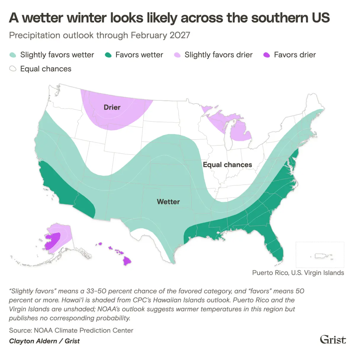
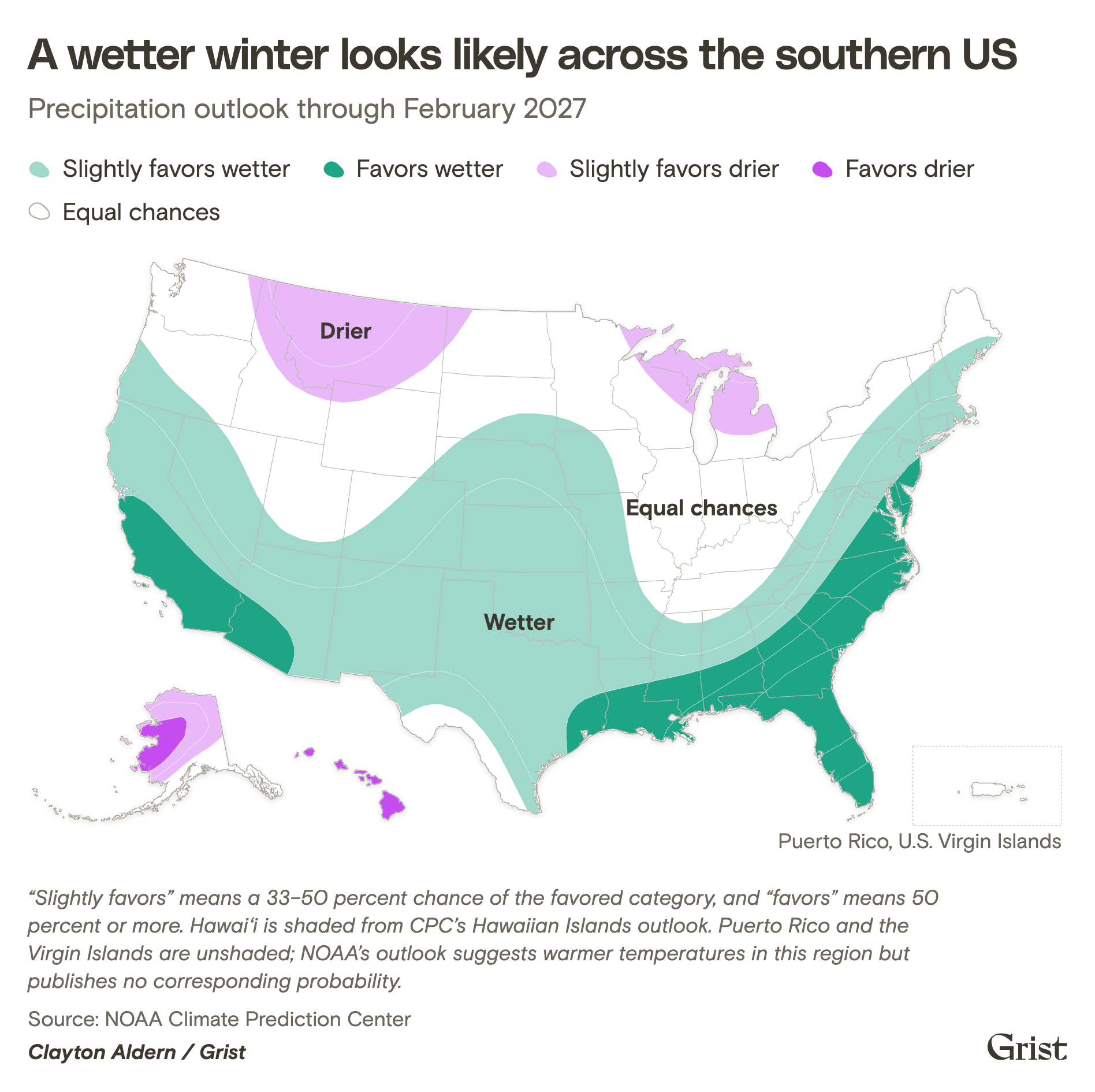
Indeed, climatologists point directly to the expanding band of unusually warm water currently sitting in the equatorial Pacific Ocean. According to seasonal outlooks published by the National Oceanic and Atmospheric Administration (NOAA), this powerful climate phenomenon is actively priming much of the southern United States for a winter defined by significantly increased precipitation.
The atmospheric setup has left experts evaluating just how rare these combined conditions truly are. When asked whether an event of this magnitude could have materialized during a non-El Niño year, Michael A. Crimmins, a climatologist at the University of Arizona, noted the compounding nature of the current cycle. "It could have, but it would have been a lot harder to pull all of the ingredients together at the same time, and would have been a lot less likely," Crimmins explained.
The Paradox of Winter Heat and Atmospheric Moisture
Paradoxically, the looming challenge for the unfolding winter season is centered around heat. The current El Niño phase has established itself as the strongest on record, and meteorological models suggest it could intensify further over the coming months. Even though a shift of just a few degrees in Pacific Ocean temperatures might sound minor on paper, that microscopic variation injects a tremendous, destabilizing amount of thermal energy into the global atmosphere. This surplus energy acts as a chaotic engine, scrambling weather patterns across the entire planet.
The influence of this warm water mass is so profound that it has actively altered global storm dynamics. For instance, high-altitude winds driven by the El Niño pattern have helped suppress hurricane formation across the Atlantic basin, leading to a remarkably quiet season in the eastern waters. This year shattered historical benchmarks for the latest first hurricane in a recorded season by nearly an entire month. In a typical year, standard meteorological tracking would log approximately six of these major tropical cyclones by this point in the calendar, but 2026 has produced only a single system thus far.
The Southwest, however, finds no such reprieve from severe weather. In addition to pumping elevated thermal energy into the sky, the abnormally warm Pacific waters are turbocharging atmospheric moisture levels. This trend extends beyond the immediate El Niño cycle, as long-term baseline temperatures across the Pacific have been running significantly hotter than average. This localized ocean heat helps explain why the western side of the ocean has already spawned 10 hurricanes this season, contrasting sharply with the quiet Atlantic.
Scientists emphasize that these oceanic anomalies are part of a broader, systemic trend: more than 90 percent of the excess heat that human activities have trapped in the global atmosphere over the past century has been directly absorbed by the world’s oceans.
Cascading Disasters and the Threat of Flash Flooding
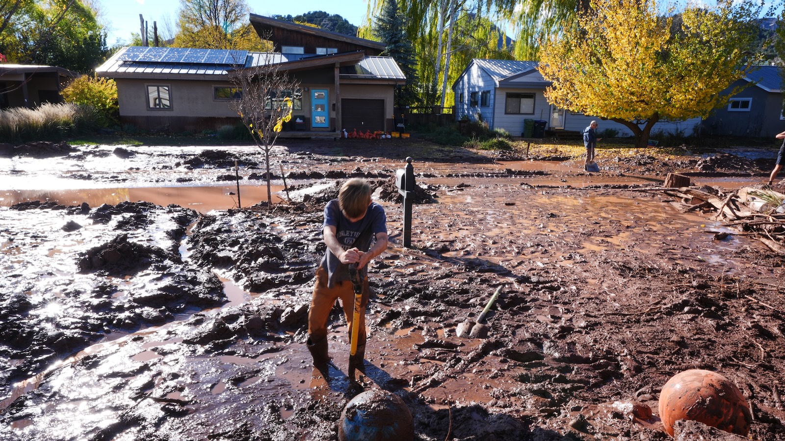
This massive reservoir of ocean heat translates directly into airborne moisture, fueling the relentless weather systems that have marched inland toward the Southwest over the past two months. A separate meteorological system in late October, for example, evolved into one of the most extreme rainfall events in Colorado’s recorded history. That multi-day storm pelted higher elevations with up to 8 inches of rain over a compressed four-day window, triggering severe mudslides, road closures, and widespread destruction across mountain communities.
"It’s just really extreme amounts of water vapor in the atmosphere that have been aimed into the Southwest in each of those storms," Schumacher noted.
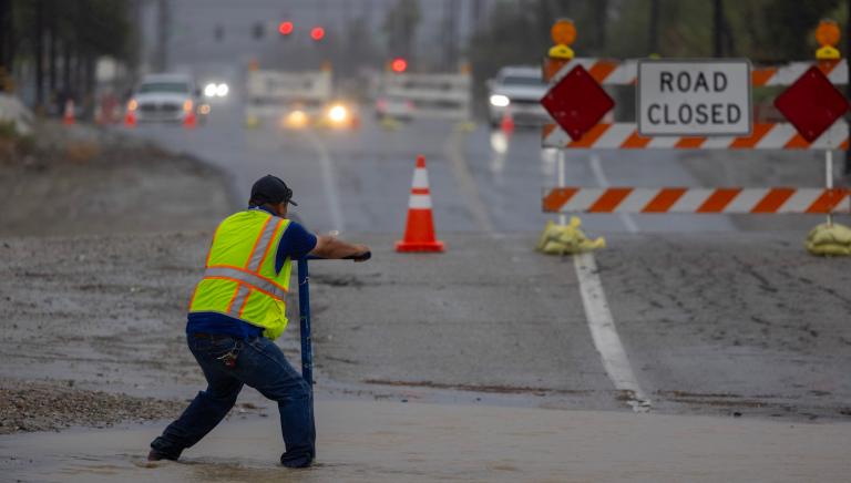
This persistent autumn precipitation effectively primed Arizona, Colorado, and surrounding states for the subsequent wave of destruction. The dynamic created a dangerous compounding effect through two primary mechanisms. First, regional rivers and streams were already running at elevated levels from earlier rains, meaning incoming moisture caused waterways to swell even higher. Second, because local soils were already fully saturated from previous downpours, any follow-up precipitation was unable to soak into the ground. Instead, it transformed into rapid surface runoff, immediately fueling widespread urban and rural flooding.
"We get the second storm, just a little bit after the first one, then everything was primed for even worse flooding this time around," Schumacher explained.
In mountainous and rugged terrain, these saturated conditions create uniquely dangerous scenarios. The local topography acts as a natural funnel, gathering massive volumes of cascading rainwater and channeling them into violent, fast-moving torrents capable of sweeping away infrastructure, vehicles, and debris.
"If you hike around the Southwest, you’re going to see out-of-place boulders all over the place," Crimmins said, pointing to the geological footprint of past hydrological events. "Water put it there. Maybe it was 5,000 years ago or something like that, but water moves. We can have really epic flash flooding."
Drought Relief and the Critical Role of Snowpack
Despite the immediate danger, property damage, and tragic loss of life caused by the recent deluges, climatologists point to a potential silver lining: the increased precipitation driven by this robust El Niño could finally offer meaningful drought relief to large swaths of the southern United States.
For years, human-driven climate change has exacerbated chronic dry spells across the region, while persistently hotter temperatures have accelerated evaporation rates from vital municipal reservoirs. Simultaneously, rapid population growth throughout the Southwest has driven unprecedented demands for water resources, placing immense strain on local supplies.
Yet, even with the recent heavy rains, experts warn that a few isolated storms cannot instantly reverse long-term deficits. The Colorado River system, which serves as the lifeblood of the American Southwest, has seen its two largest storage vessels—Lake Powell and Lake Mead—hover near critical thresholds in recent years. While the potential for sustained winter rainfall will undoubtedly help boost water levels temporarily, Schumacher cautions that it is insufficient to pull the overarching river basin out of its multi-decade decline.
"It’s a long way to go to get even back to where we were a year ago," Schumacher said, "let alone when it was in good condition decades ago."
A major wildcard for the remainder of the season is the region’s winter snowpack. Climatologists emphasize that it remains too early to reliably predict how much snow will accumulate in the high country of Colorado and surrounding states. The distinction between rain and snow is critical for water management: while heavy rainfall generates immediate runoff that overwhelms local river channels and municipal infrastructure, high-altitude snowpack acts as a natural frozen reservoir, releasing water slowly and steadily as the mountains thaw through the spring and summer months. Following a historically low snowpack measurement earlier this year, Colorado remains in urgent need of a robust winter snow season to secure its hydrological future.
While municipal water agencies and regional governments cannot control day-to-day weather patterns, communities are increasingly shifting how they manage the water that does arrive. In Arizona, municipalities such as Tucson have invested heavily in green infrastructure initiatives, integrating engineered land features and specialized native landscaping designed to slow down stormwater runoff, capture moisture, and hydrate local flora before it can pool into destructive urban floods.
"There’s really cool and clever ways of thinking about stormwater as a resource," Crimmins said, "rather than a nuisance."