
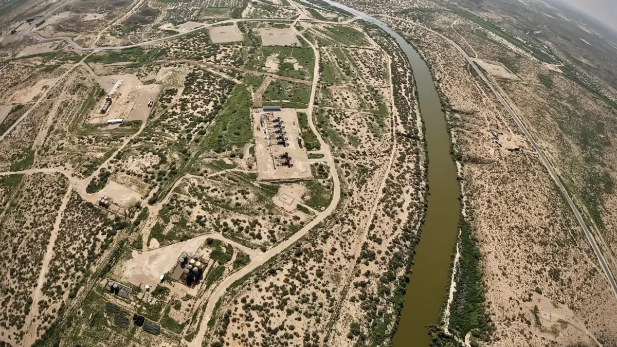
It is an early May afternoon in southern New Mexico, just a mile from where the Black River empties into the Pecos River. Charlie Barrett has parked his pickup truck in a gravel pullout along a county road, stepping out into an atmosphere that hums with the distant, constant rumble of heavy machinery and commercial transport. He has stopped here to set up a specialized video camera—a device capable of detecting heat signatures and invisible gases—to check for unpermitted emissions from a nearby oil and gas operation.
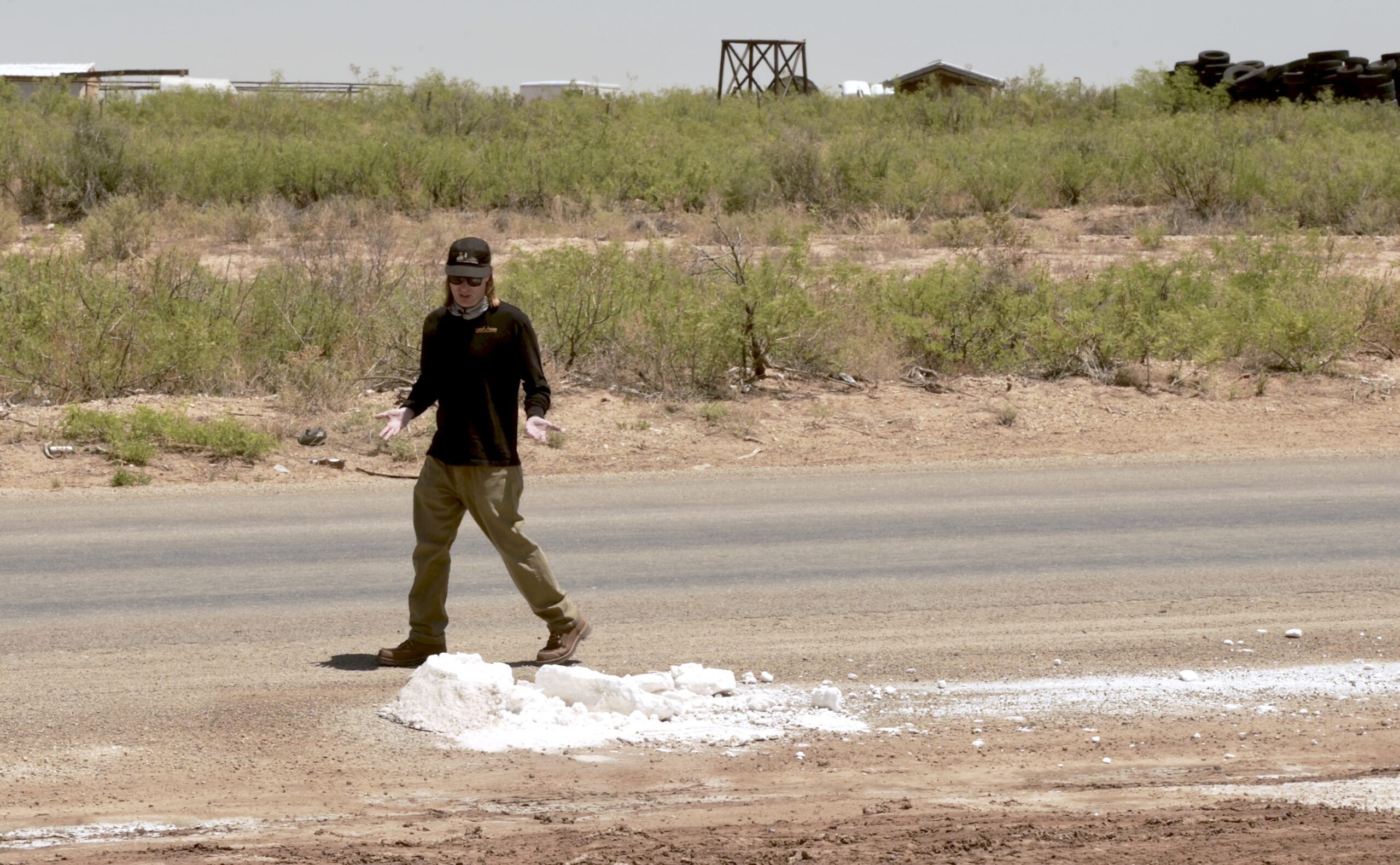
Stepping out of the vehicle, Barrett finds the ground beneath his boots muddy and dotted with lingering puddles. In the middle of an ongoing, severe regional drought, standing water is an immediate anomaly. Near one of these muddy patches sits a gray chunk of salt roughly the size of a medicine ball, surrounded by a dusting of shimmering white crystals.
“Unfortunately this is pretty common,” Barrett said, surveying the ground. “It’s also quite dangerous.”
It quickly becomes apparent that someone has illegally dumped oilfield wastewater—frequently referred to as “produced water”—directly at the roadside pullout. This extremely saline and toxic byproduct of oil and gas production carries a hazardous cocktail of petroleum compounds, heavy minerals, and commercial oilfield chemicals. Depending on the geological formation from which it was extracted, produced water can also carry dangerous levels of radioactivity. Barrett notes his immediate worry that unsuspecting motorists might drive through the muck or that workers and travelers might pull off the road and unknowingly track the toxic residue through the environment.
Throughout the day and night, hundreds of heavy semi-trucks haul this toxic produced water from well sites to disposal and injection stations, navigating the highways and remote backroads of this far corner of New Mexico. The fluid is an unwanted and unavoidable byproduct of modern fossil fuel extraction. According to industry data, more than three barrels of wastewater come out of the ground for every single barrel of extracted oil, on average, across New Mexico operations.
As fossil fuel production has skyrocketed across the vast expanse of the Permian Basin, the volume of produced water has risen in tandem. Compounding the issue, the water-to-oil ratio naturally increases as individual wells and oilfields age—a geological process known within the industry as “watering out.”
New Mexico state regulations strictly ban the use of produced water for anything outside of approved oilfield operations. This regulatory reality has given rise to a massive, parallel industrial network devoted entirely to gathering, transporting, and reinjecting produced water deep underground. That massive underground pressure shift has, in turn, fueled a dramatic rise in regional seismic activity, triggering minor earthquakes and raising concerns over structural failures. It has also led to high-profile surface blowouts, where failed injection wells occasionally rupture and send geysers of toxic wastewater shooting high into the air.
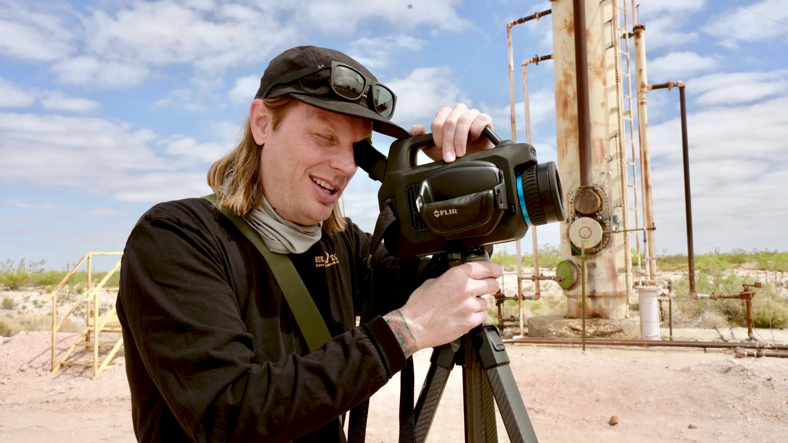
Barrett works as a thermographer for Oilfield Witness, an industry watchdog organization. Using his optical gas imaging equipment, he travels across oil-producing regions to document gaseous emissions that escape from aging or poorly maintained oilfield infrastructure. As he finished setting up his equipment on the roadside, a steady stream of heavy trucks hauling produced water rumbled down the highway under a blazing, cloudless sky.
Barrett began filming the horizon. “Oh, man, that’s fucking terrible,” he murmured.
Through the small viewfinder screen, rendered in wavy, candy-colored hues that map thermal radiation, the camera revealed the intense heat signatures of three active industrial flares burning brightly in close proximity to a residential home.
“Got a person’s home here and then this mess — all producing CO2 and methane and other volatile organic compounds, blowing right into their home,” Barrett said, shaking his head as he looked through the lens. “Jesus, man. It’s ridiculous.”
When he reviewed the footage later on a larger computer monitor, he discovered yet another lit flare captured in the same sweeping frame, bringing the total to four active flares in a single shot. This industrial burning was occurring despite the fact that the State of New Mexico enacted a near-total ban on routine flaring in 2022.
Energy companies typically burn off, or “flare,” natural gas for several operational reasons: the gas may not meet pipeline quality specifications, it may be over-pressurized within local collection lines, or burning may be required during routine equipment maintenance. While flaring is considered preferable for the global climate compared to directly venting unburned methane—a potent greenhouse gas—straight into the atmosphere, the process still releases vast quantities of carbon dioxide and other hazardous air pollutants into the immediate local environment.
Later in the day, Barrett sat down on a small, weathered boulder along a quiet bend in the Pecos River to reflect on his work. The river babbled softly over smooth stones; dragonflies hovered above the surface, and tall riverside grasses rustled in the breeze. But the peaceful scene was constantly punctured by the heavy rumble of oilfield trucks crossing a nearby bridge—a stark reminder that this tranquil sanctuary exists directly inside one of the most prolific fossil fuel basins on the planet.
“It sucks,” he said, looking out over the water. “It’s a beautiful river in the middle of a hellscape.”
During his previous visit to this exact spot several months earlier, Barrett found heavy salt deposits coating the terrain between the bridge and the riverbank. “I mean, the whole road was flooded over,” he recalled. While observers could not definitively prove whether the flood was caused by an active, uncontained produced water spill or runoff from nearby facilities, local experts note there are few other viable explanations for heavy salt accumulations in an arid desert environment.
Such an incident would represent yet another severe environmental shock for a waterway already struggling under immense ecological pressure. The supreme irony of the region is that the Pecos River desperately needs more water, not less. Long-term data compiled by the U.S. Geological Survey over nearly four decades shows a slow but steady decline in the annual mountain snowpack feeding the river’s headwaters. Streamflow measurements recorded at monitoring stations upriver in the town of Pecos reflect the exact same downward trajectory.
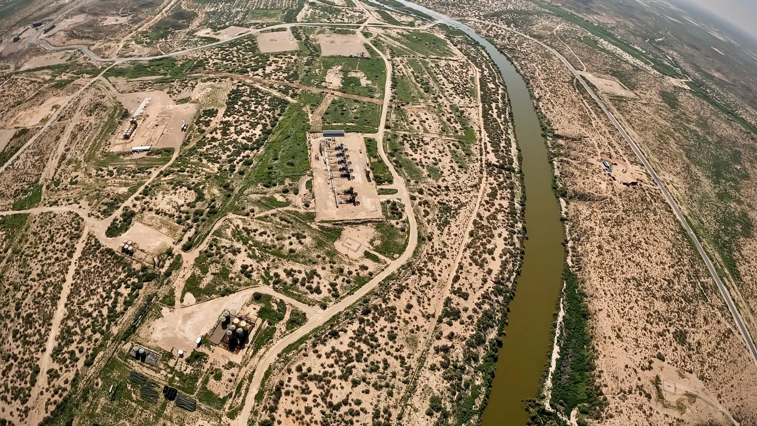
As global climate change continues to heat and dry the American Southwest, causing the Pecos River to run lower with each passing year, one of the primary global drivers of that warming sits directly on the river’s banks. Just feet from where Barrett sat flows the influence of the Permian Basin—a massive energy-producing geological formation spanning roughly 75,000 square miles across 55 counties in New Mexico and Texas.
Water and Geology
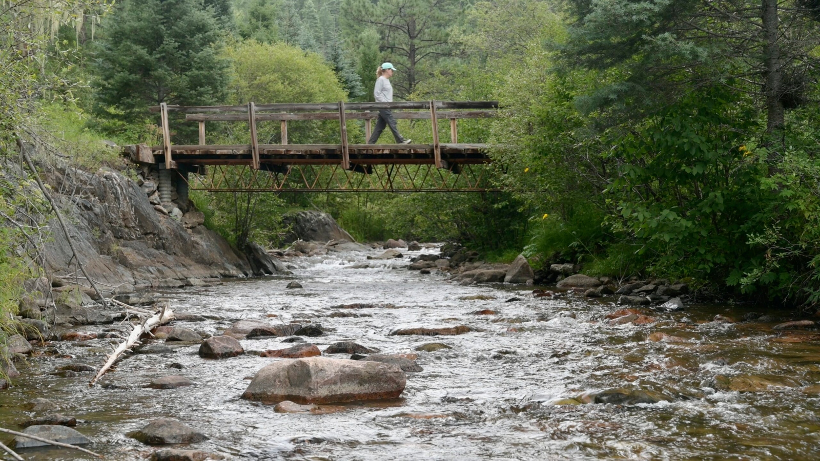
The Pecos River occupies a storied place in American geography and lore. Familiar to generations through popular culture and celebrated as a historic demarcation line of the Wild West, the river originates high in the rugged mountains east of Santa Fe. It winds its way south for more than 500 miles before finally crossing the border into Texas at New Mexico’s lowest elevation point.
In its upper reaches, the river’s headwaters rush untamed through steep, dramatic canyons and pine-covered slopes, earning the waterway a prestigious National Wild and Scenic River designation. Farther down, its waters sustain essential farms and ranches across the central plains of New Mexico. Yet by the time the river exits the state, it bears little resemblance to a wild mountain stream. Instead, it looks more like a tightly managed artificial conveyance, engineered to deliver carefully tallied water quotas right through the heart of the nation’s most productive oil and gas extraction zone.
The environmental advocacy organization American Rivers has repeatedly sounded the alarm over the river’s diminishing health, naming the Pecos to its annual list of the country’s most endangered rivers. It earned the dubious distinction on its own in 2021, and again in 2024 alongside other vital New Mexico waterways.
Both the river and the Permian Basin represent natural features of a landscape fundamentally transformed by humanity’s insatiable demand for energy derived from fossil fuels. Over the past century, energy developers have drilled tens of thousands of deep wells, stitched the desert floor with a complex web of pipelines, and released ancient carbon trapped deep underground for tens of millions of years, all to power vehicles, aviation, and modern infrastructure. That massive historical release of carbon has fundamentally altered the chemistry of the global atmosphere, trapping heat that warms the planet, accelerates regional aridification, and starves New Mexico of essential moisture.
Meanwhile, along the Pecos River, water managers face a relentless mathematical reality: a rising municipal and industrial demand for dwindling supplies of water. Last winter’s exceptionally poor snowpack accumulation only heightened those fears.
“It is totally terrifying in a lot of ways,” said Hannah Riseley-White, director of the New Mexico Interstate Stream Commission. Her challenging mandate is to ensure that the state successfully fulfills its strict legal obligations to all the diverse stakeholders who hold a legal stake in the river’s dwindling water.
“Everyone this spring got tired of me at the beginning of every meeting screen-sharing the snowpack figures for all of the basins that we manage,” Riseley-White said. “It fell off the cliff. It wasn’t just record breaking. It was beyond anything that we could have imagined in terms of snowpack.”
The preceding winter provided little relief, and long-term hydrologic forecasts offer little comfort. Riseley-White noted that state models project a severe 25% to 30% reduction in overall river flows by the year 2070.
“So the biggest challenge that the Pecos faces is just aridification due to climate change,” she said.
Those sobering figures form the foundation of New Mexico Governor Michelle Lujan Grisham’s comprehensive 50-Year Water Action Plan, a state strategy detailing how accelerating global warming will shrink New Mexico’s accessible water supplies in the coming decades. The plan outlines proposed measures to conserve existing freshwater reserves and develop alternative water sources in an increasingly parched environment. Among the most controversial proposals is the potential treatment of oilfield wastewater—the exact toxic byproduct Barrett suspects he found spilled along the roadside—to purify it to a standard where regulators might permit its use outside the oilfield for broader industrial, agricultural, or municipal applications.
“The industry’s actually advocating for repurposing produced water and pumping it into this river,” Barrett noted while sitting near the riverbank.
To date, legal and regulatory efforts to implement widespread produced water reuse have faced intense pushback. A recent administrative push to alter state rules to permit the broad commercial use of treated industrial wastewater collapsed after Governor Lujan Grisham’s administration appeared to influence the deliberations of the state rulemaking commission. Although industry proponents continue to press for regulatory reform, no firm timelines have been established. State conservation and environmental groups remain fiercely opposed to the initiative, arguing that current advanced treatment technologies cannot guarantee the 100% removal of all complex, toxic chemical compounds.
Across the state line in Texas, the Lone Star Chapter of the Sierra Club has documented at least five separate proposals submitted to state regulators seeking authorization to discharge treated produced water directly into the Texas portion of the Pecos River watershed, though none of those discharge permits have yet received final approval.
“Do I think [treated] produced water will solve all of our problems in the Pecos? No,” Riseley-White said. “But thinking about it as one of the many sort of tools in the toolbox I think makes sense.”
She added that creative water management will require evaluating every available option. “I think technology is there to clean water to various standards. It’s just a question of whether financially the incentives are there.”
Other Dangers
A diverse array of fragile and endangered wildlife species relies on the dwindling riparian habitat along the Pecos River. Among them are the dunes sagebrush lizard and the Texas hornshell mussel. The lesser prairie chicken was also part of that vulnerable ecological group until the U.S. Fish and Wildlife Service formally stripped its federal protections under the Endangered Species Act in early 2026, despite documented declines in its remaining wild populations.
“There’s going to be just increasing challenges in ensuring that there’s sufficient water for those species, just like for the other users that depend on it,” Riseley-White said.
She pointed to localized conservation success stories as a model, noting that while state officials worked to protect the Texas hornshell along a tributary of the Pecos, local landowners realized a profound truth. “Landowners recognized that if there was water in the Black [River] for the hornshell, that meant that there was water there for them, too,” she said.
However, wildlife advocates warn that newly enacted policy changes from Washington threaten these fragile ecosystems. The U.S. Department of the Interior rolled back the regulatory definition of “harm” under the Endangered Species Act, narrowing it to mean only direct, physical injury or the outright killing of a protected specimen. Under the revised interpretation, secondary impacts such as chronic noise pollution, habitat fragmentation, and industrial disturbance are no longer recognized as legally actionable threats to an endangered species’ survival.
Later, the department rescinded the historic “blanket rule” that automatically extended robust protections to newly threatened species, aligning them with endangered classifications. The updated federal regulations also mandate the formal consideration of the economic costs of protecting rare plants and animals—introducing financial burdens directly into conservation equations, including the operational costs borne by fossil fuel companies.
Taken together, these regulatory shifts dismantle decades of environmental protections across the United States, including those safeguarding the delicate habitats within the Pecos River watershed. The industrial footprint here is immense: out of the thousands of active oil and gas wells piercing the earth in New Mexico’s sector of the Permian Basin, roughly 380 wells sit within a half-mile of the Pecos River itself. Another 11 deep-injection wells, utilized exclusively for the underground disposal of toxic produced water, operate within that same narrow ecological corridor.
“The sound pollution and light pollution also affect this river ecosystem,” Barrett noted. Drawing on his academic background in ecology and wildlife management—which included prior professional service as a staff ecologist for the Texas Parks and Wildlife Department and the Texas A&M Forest Service—he warned that unrelenting industrial disturbance carries severe biological consequences.
“It drives a lot of species away from this ecosystem,” Barrett said, “which can lead to extirpation, which is regional extinction.”
Despite the staggering array of environmental, climatic, and regulatory hurdles facing the region, Riseley-White maintains a measured sense of optimism regarding the future of the river.
“My hope in the Pecos is that as we face these challenges, we can get all of the different interests at the table and find solutions that make sense to everybody,” she said. “I think it’s challenging, but I think it’s definitely possible.”